Three more shared streets added in August. Are there more that could be created?
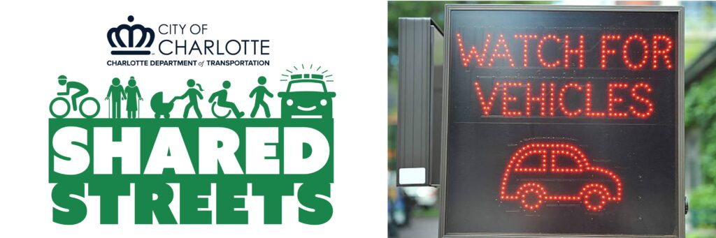
Shared streets updated in Phase 3
On August 15, three more streets joined the six existing ones to give the City of Charlotte a total of nine Shared Street segments.
The continued theme of giving people access to parks was expanded in Phase 3 as new connections were made. Could Charlotte be doing more with Shared Streets? Let’s take a closer look at what other cities are doing.
First, we’ll introduce you to the new additions added by the City.
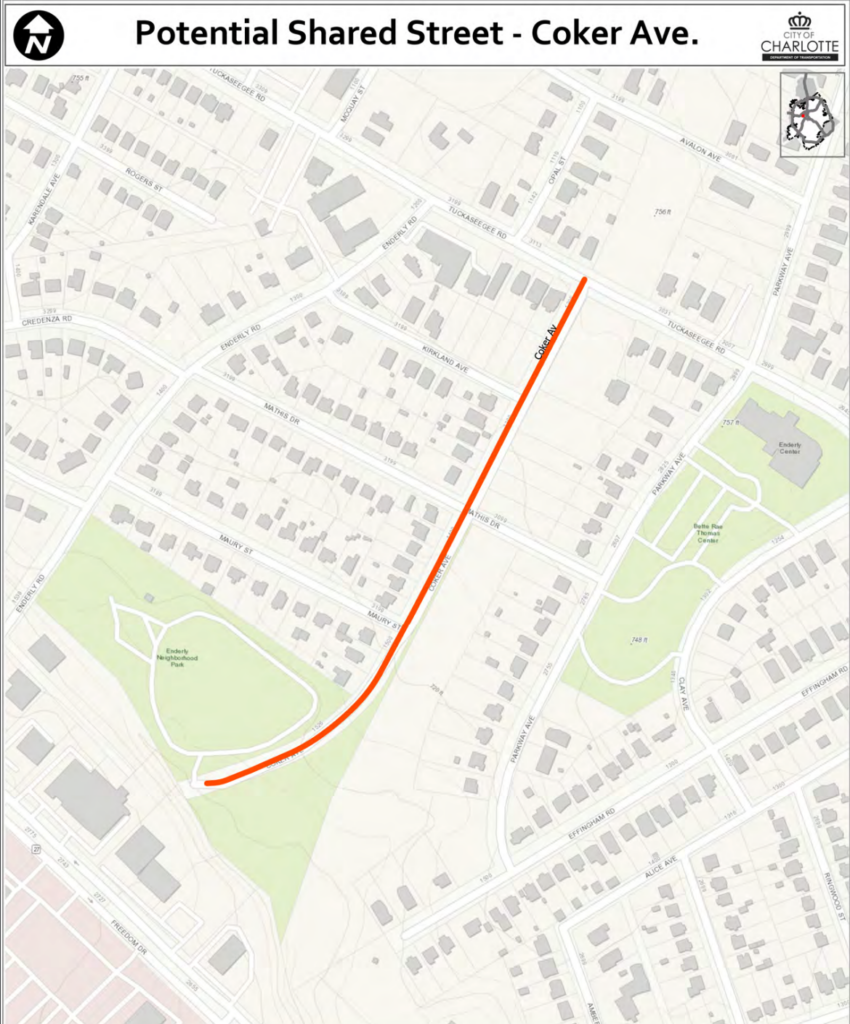
Coker Ave (from Tuckaseegee Rd to the end of Coker Ave)
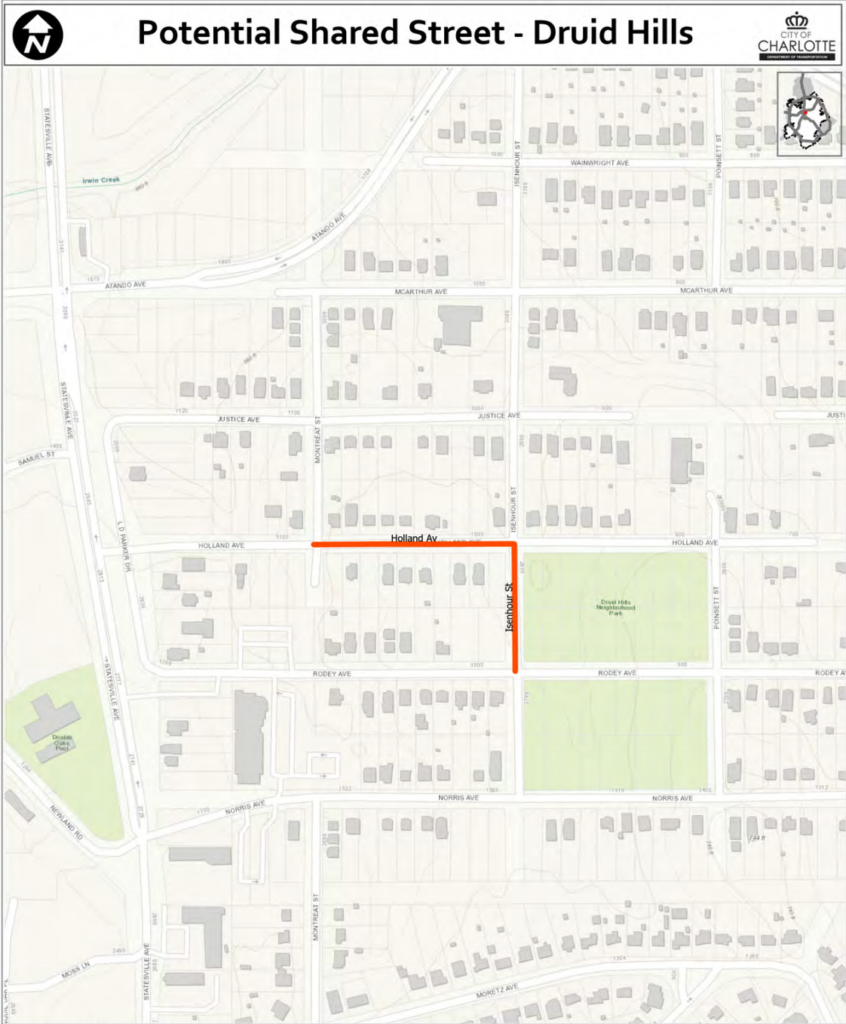
Druid Hills (Holland Ave, from Montreat St to Isenhour St; Isenhour St, from Holland Ave to Rodey Ave)
Ruth Dr (Shannonhouse Dr, from The Plaza to Ruth Dr; Ruth Dr, from Shannonhouse Dr to the end of Cottage Cove Ln)
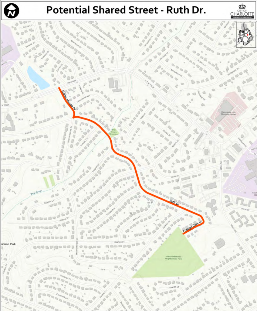
Image credit: City of Charlotte DOT
It’s really exciting to see these new connections, but what more could Charlotte be doing when it comes to Shared Streets? What are other cities doing to capitalize on the opportunities to change streets and improve mobility options?
We looked into possible answers to those questions and found a reference guide put together by NACTO (National Association of City Transportation Officials). Here are just a few examples they shared:
1. Slower shared streets
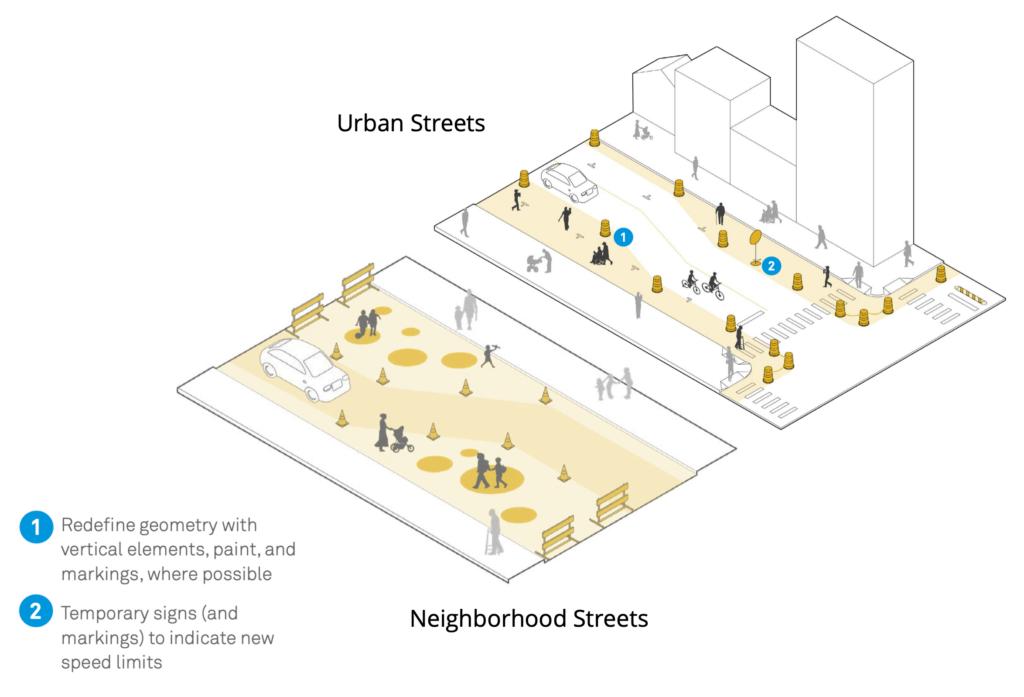
Image credit: NACTO.org
Key Characteristics:
- Reduce the posted speed limit to a level consistent with eliminating serious injuries and update markings and signs.
- Deploy quick-build designs and/or pair with other street or public space interventions.
- Publicize speed limit and anti-speeding message with media campaigns.
2. Try out more transit-only lanes + add more space at stops
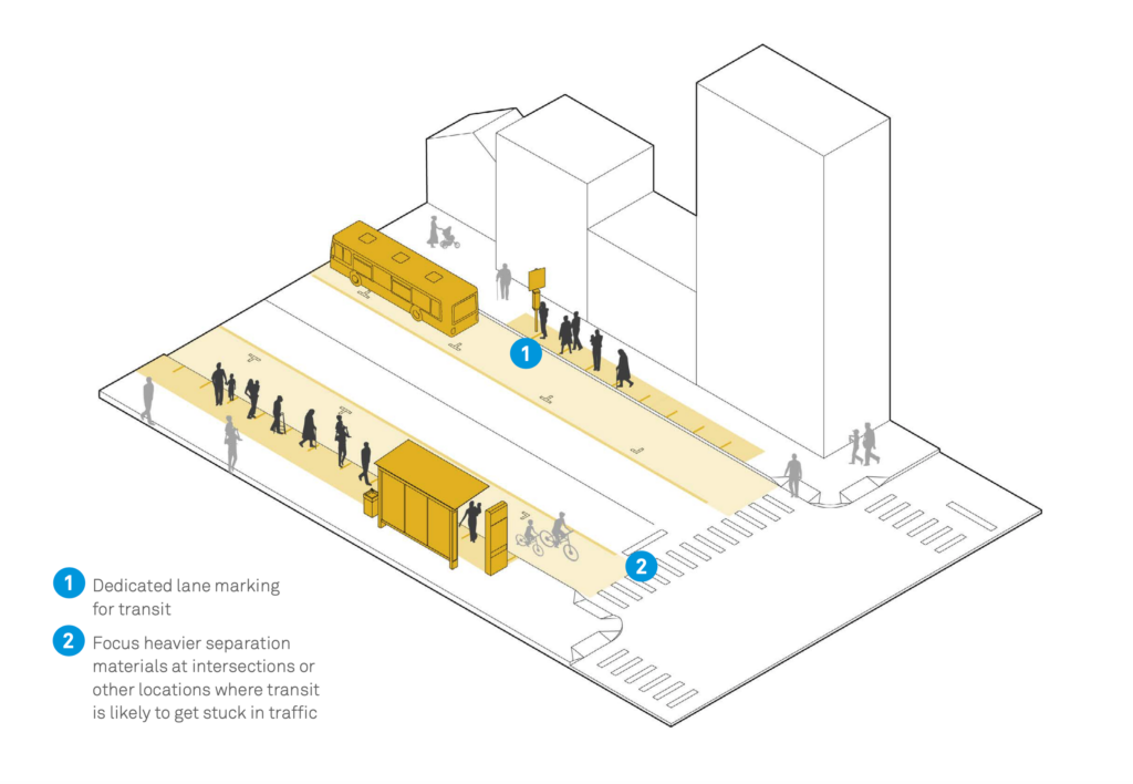
Image credit: NACTO.org
Image credit: NACTO.org
Key Characteristics:
- Convert curbside parking or motor vehicle lanes to surface transit lanes.
- Designate the transit lane with lane markings, regulatory signs, electronic signs if available, and vertical elements such as cones.
- Deploy platforms with interim materials, such as curbs plus asphalt and modular islands
- Install ramps, crosswalks, and safety islands to access mid-block stops.
- Ease rear boarding via mobile ticketing, on-board contactless payment, and off-board fare collection.
Other ideas for repurposing space on streets presented in the guide were achieved by adding Bike and Roll Lanes, Pick and Delivery Zones, Outdoor Dining, Markets, Events, and something very timely space for Protesting.
While looking into what other cities were doing, we discovered another insight.
“The streets and cities we see on the other side of the pandemic will be different from the ones we knew a few short months ago. As city and transportation leaders, our job is not to return to the inequitable, dangerous, unsustainable patterns of the past, but to help shape a better future. The streets we create today will provide the foundation for our recovery for years to come.” – NACTO – Streets for Pandemic Response and Recovery
Changing how we use our streets isn’t just about the present day, but could be a springboard for building a healthier, more equitable future.
Let CDOT know you would like to see more!
Thanks for reading!
As a nonprofit, community support is essential for us to keep doing what we do — including providing free articles like this. If you found this article helpful, please consider supporting Sustain Charlotte.
Want to stay in the loop? Subscribe to our weekly newsletter and follow us on Instagram, Facebook, and Twitter.