What’s next for Charlotte’s urban future?
A quick update on the Center City Vision Plan, Streets Map, and Comprehensive 2040 Plan.
At this week’s Transportation and Planning Committee meeting City staff updated our City Council members on the committee with a look at the following:
Streets Map
The update given at the meeting let us know that the open period for feedback will close at the end of this month. It also stressed what the Streets Map goal is and what it isn’t.
What the Streets Map does do is:
- Describes the expected complete street cross-section for the streets around the Blue Line corridor.
- Used for applying TOD (Transit Oriented Development) through development:
- Provides consistency and predictability for development
- Defines curb line
- Helps determine other design elements in TOD
What the Streets Map doesn’t do is:
- Show “projects”
- Indicate priority
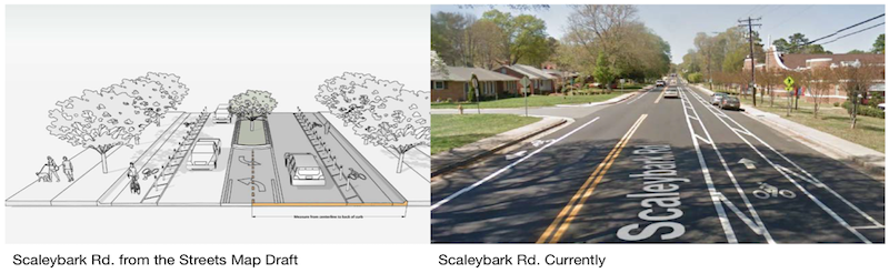
- Serve as a specific project design for any street; “So even though it is a starting point for a project, it is not necessarily a very specific design; (….)” – Tracy Newsome, CDOT
Council Member Braxton Winston asked this question in regards to the below image, “How committed are we to that?” Tracy Newsome followed up a little later explaining that “it is not actually a project, it is expected future amount of space to get a good project when that project comes online.”
A call to action
The open period for comments will close at the end of September. So please if you haven’t, go and give your feedback on the streets you use or would like to see improved. We also ask that you let CDOT and City Council know the following:
- I support the Streets Map in defining the design for future facilities. I want to see future projects reflected in the map.
- I want to see how other projects like the Bicycle Network connect in the Streets Map.
- I understand flexible is needed; however, we want certainty with specific elements of design. Such as:
-
-
- Lane width and number of lanes
- Using protected cycle facilities over standard ones
- Where and when on-street parking is located and used on a street
-
-
The Streets Map should be just as clear and detailed as each of the specific Place Types are in TOD and the future UDO.
View the draft here: bit.ly/CLTStreetsMap or https://charlottenc.gov/Projects/Pages/StreetsMap.aspx
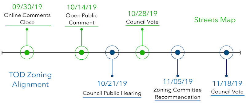
Timeline for streets map draft
2040 comprehensive plan update
We are currently in Phase 2 out of the 4 phases of the Comprehensive Plan. This phase includes Scenario planning for future growth. The overall timeline is below:
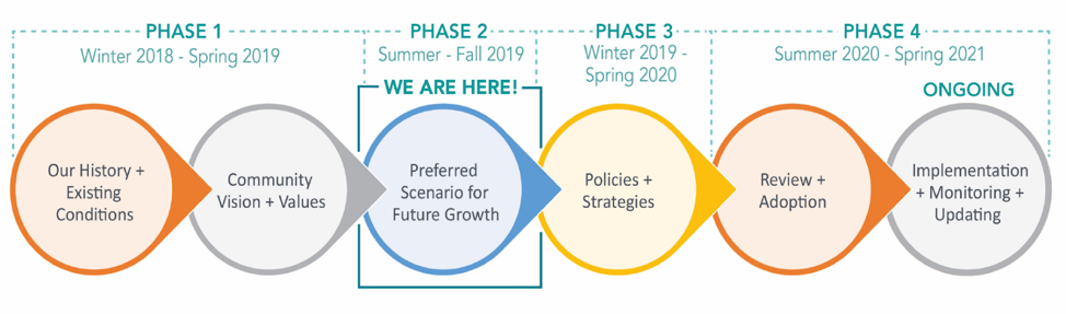
Image courtesy of City of Charlotte
A sneak peek at the possible alternative growth scenarios
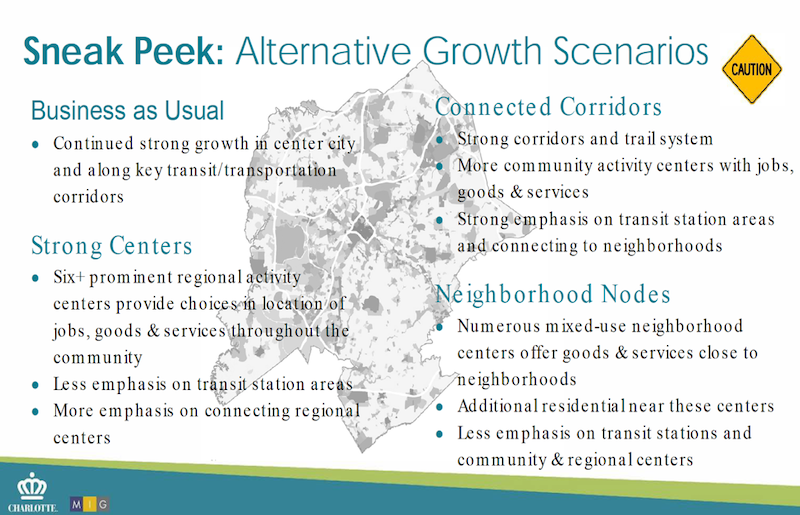
Image courtesy of City of Charlotte
What’s next for the comprehensive plan
City Council and the Planning Commission will both have their chance at a strategy session on October 7th. After that, the public will have the opportunity to see the game results and hear about the growth scenarios here:
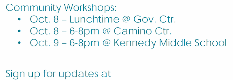
Center City 2040 Vision Plan Overview
This plan will be updating the 2020 Plan that was adopted in 2011. The 2040 Center City Vision Plan will go beyond Center City when it comes to outreach. They will be extending the involvement to the surrounding neighborhoods for at least a three-mile radius.

Image courtesy of Center City Partners
WHAT’S NEXT?
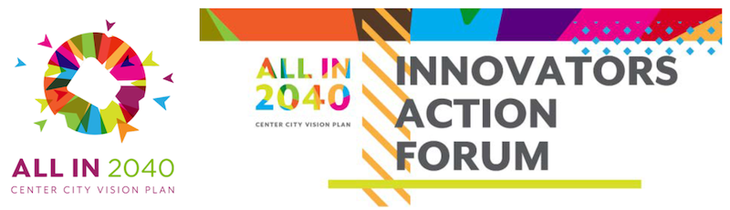
Image courtesy of Center City Partners
Innovators Action Forum – Wednesday, 2 of October @ 6:00pm – 8:00pm
The program will be hosted in the McGlohon Theater at Spirit Square
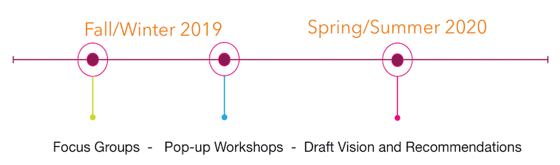
Timeline
As supporters of sustainability, when your schedule allows, please attend these meetings. Provide your feedback but also be willing to listen and learn from others and city staff. The City will grow better when many voices are heard.
Thanks for reading!
As a nonprofit, community support is essential for us to keep doing what we do — including providing free articles like this. If you found this article helpful, please consider supporting Sustain Charlotte.
Want to stay in the loop? Subscribe to our weekly newsletter and follow us on Instagram, Facebook, and Twitter.